 Catalogue CIRAD
Collection: A spatial dataset of large herbivore distributions and their environmental, climatic, and anthropogenic drivers in the Amboseli ecosystem, Kenya, 2024
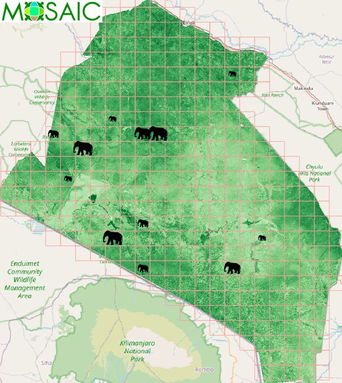
The dataset provides a spatially harmonized integration of grid-based animal aerial count observations and environmental covariates for the May 2024 survey period in the Amboseli ecosystem :
- Count and density estimates for six large herbivore species—elephants, giraffes, zebras, wildebeest, Thomson’s gazelles, and cattle—are aggregated to a 5 kilometre by 5 kilometre sampling grid derived from aerial surveys;
- Environmental variables are processed and aligned to this aerial survey grid framework using spatial aggregation. The variables include spectral indices for vegetation (Normalized Difference Vegetation Index (NDVI), Enhanced Vegetation Index (EVI), and Modified Soil Adjusted Vegetation Index (MSAVI)), water (Normalized Difference Water Index (NDWI)), and built-up areas (Normalized Difference Built-up Index (NDBI)). Additional covariates comprise precipitation and temperature data, built areas, and rivers, streams, and roads.
For each grid cell, the minimum, mean, and maximum values, as well as valid pixel counts and missing data fractions, document within-cell variability and data completeness.
This dataset is freely accessible (CC-BY license) provided that the following reference is cited: "Wanjiku, Angela; Marti, Renaud, Mose, Victor N., Tran, Annelise, 2026. A spatial dataset of large herbivore distributions and their environmental, climatic, and anthropogenic drivers in the Amboseli ecosystem, Kenya, 2024. CIRAD GeoDE." https://doi.org/10.18167/GEODE/9390
Simple
- Date (Creation)
- 2025-12-01
- Date (Publication)
- 2026-02-25
- Citation identifier
- urn:uuid/b9e95e13-ab10-4da6-8b85-f3266ef621d8
Identifier
- Cited responsible party
-
Role Organisation Electronic mail address Custodian Author UMR TETIS
500 rue Jean François Breton34093 Montpellier Cedex 3France-
Wanjiku, Angela

-
Tran, Annelise
-
Marti, Renaud
Author Originator Funder European Union
-
Wanjiku, Angela
- Presentation form
- Digital map
- Purpose
-
The dataset provides a standardized environmental covariate matrix linked to systematically collected animal observations, enabling consistent examination of species distributions and environmental context at the survey scale within the ecosystem.
- Status
- Completed
- Point of contact
-
Role Organisation Electronic mail address Point of contact
- Spatial representation type
- Vector
- Spatial representation type
- Grid
- Spatial representation type
- Text, table
Extent
))
Temporal extent
- Time period
- 2024-01-01 2024-12-31
- Maintenance and update frequency
- Not planned
- AGROVOC Multilingual Thesaurus
-
-
Sentinel-2
-
remote sensing
-
- Keywords
-
-
remote sensing
-
Resource constraints
- Language
- English
- Character encoding
- UTF8
- Supplemental Information
-
Fundings: European Union, Horizon Europe research and innovation programme (Horizon Europe,2021-2027), Multi-site Application of Open Science in the Creation of Healthy Environments Involving Local Communities (MOSAIC) project
- Distributor contact
-
Role Organisation Electronic mail address Distributor CIRAD
Centre de coopération internationale en recherche agronomique pour le développementSiège social42, rue Scheffer75116 ParisFrance
- OnLine resource
-
Digital Object Identifier (DOI)
- Hierarchy level
- Collection
- Other
-
The dataset provides a standardized environmental covariate matrix linked to systematically collected animal observations, enabling consistent examination of species distributions and environmental context at the survey scale within the ecosystem.
Report
Result
- Date (Publication)
- 2008-12-03
- Explanation
-
Conformité aux règles d'implémentation INSPIRE pour les métadonnées
- Pass
- true
- Statement
-
Details regarding each subdataset are provided in the corresponding metadata file.
- Reference system identifier
- EPSG:32737
- Reference system type
- Projected
- Maintenance and update frequency
- As needed
Metadata
- Metadata identifier
- urn:uuid/b9e95e13-ab10-4da6-8b85-f3266ef621d8
- Language
- English
- Character encoding
- UTF8
- Contact
-
Role Organisation Electronic mail address Point of contact UMR TETIS
Type of resource
- Resource type
- Collection
- Name
-
The dataset provides a standardized environmental covariate matrix linked to systematically collected animal observations, enabling consistent examination of species distributions and environmental context at the survey scale within the ecosystem.
- Metadata linkage
-
https://geode.cirad.fr/geonetwork/srv/api/records/b9e95e13-ab10-4da6-8b85-f3266ef621d8?language=all
- Date info (Revision)
- 2026-07-28T10:06:41.238748Z
- Date info (Creation)
- 2026-02-25T08:42:40.19058Z
Metadata standard
- Title
-
ISO 19115-3.2018
)))