 Catalogue CIRAD
Martinique - 2024 - Land cover reference spatial database
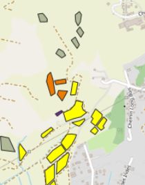
We are releasing a reference database created to train a supervised satellite image classification algorithm for the production of land use maps of Martinique in 2024.
A detailed report describing the data and methods used is available (see link in online resources).
This data is freely available (CC-BY licence), provided that this reference is cited: "Dupuy, Stéphane; Lelong, Camille; Villers, Alexandre, 2026, "Martinique - 2024 - Base de données de référence de l'occupation du sol", CIRAD GeoDE, https://doi.org/10.18167/GEODE/9295 "
Simple
- Date (Creation)
- 2026-01-15
- Date (Publication)
- 2026-01-15
- Citation identifier
- urn:uuid/d950560e-9456-48f7-ac1e-4ec45fe95d48
Identifier
- Cited responsible party
-
Role Organisation Electronic mail address Custodian Author UMR TETIS
500 rue Jean François Breton34093 Montpellier Cedex 3France-
Dupuy, Stéphane

-
Lelong, Camille
Author OFB, DRAS, Service Conservation et Gestion des Espèces à Enjeux
-
Villers, Alexandre
Originator CIRAD
Centre de coopération internationale en recherche agronomique pour le développementSiège social42, rue Scheffer75116 ParisFranceFunder OFB
-
Dupuy, Stéphane
- Presentation form
- Digital map
- Status
- Completed
- Point of contact
-
Role Organisation Electronic mail address Point of contact Point of contact UMR TETIS
500 rue Jean François Breton34093 Montpellier Cedex 3France
- Spatial representation type
- Vector
- Topic category
-
- Farming
- Environment
- Imagery base maps earth cover
Extent
))
Temporal extent
- Time period
- 2023-12-15 2025-07-03
- Maintenance and update frequency
- Not planned
- Keywords
Resource constraints
- Language
- Français
- Character encoding
- UTF8
- Distribution format
-
-
ESRI Shapefile
-
- Distributor contact
-
Role Organisation Electronic mail address Distributor CIRAD
Centre de coopération internationale en recherche agronomique pour le développementSiège social42, rue Scheffer75116 ParisFrance
- OnLine resource
-
TETIS:BD_Ref_972_v10
Martinique Base de données de référence
- OnLine resource
-
TETIS:BD_Ref_972_v10
WFS download service
- OnLine resource
-
Télécharger depuis un site web
Dupuy Stéphane, Lelong Camille, Gaetano Raffaele, Villers Alexandre. 2026. BIOTAMAYA. Rapport méthodologique pour la production de carte d'occupation du sol – Martinique en 2024. Montpellier : CIRAD, 71 p.
- OnLine resource
-
Digital Object Identifier (DOI)
- Hierarchy level
- Dataset
Report
Result
- Date (Publication)
- 2008-12-03
- Explanation
-
Conformité aux règles d'implémentation INSPIRE pour les métadonnées
- Pass
- true
- Statement
-
The attribute table contains the codes and names of the classes for the three levels of the nomenclature. The ‘Source’ column indicates the origin of the data:
- BD TOPO IGN: polygons from the BD TOPO product distributed by IGN. This is a random selection of 3,534 polygons of various buildings added to the ‘buildings’ class in the database (after verification against the Pléiades image);
- 2017 vegetation formations: polygons that have been digitised taking into account the mapping of vegetation formations in Martinique in 2017 (source: https://catalogue.geomartinique.fr)
- GPS OFB 2024: 90 GPS geolocated points collected by the OFB from 5 to 9 April 2024. They are fully described in terms of land use class.
- GPS Cirad 2025: 974 GPS geolocated points collected by Cirad between 6 and 17 January 2025. They are fully described in terms of land use class and plant composition where applicable (inventories of the main species present in the plot). These surveys were carried out mainly on agricultural areas, which are the most complex to map;
- CIRAD PIAO: certain classes are easily identifiable without error by photo interpretation of the image (examples: water, beaches, rocks, bamboo, padzas, etc.). These are therefore surveys added to the database directly by the photo interpreter, digitised on the Pléiades image along with other useful data);
- RPG 2023: the 2023 graphic parcel register (RPG) (2023 version distributed by IGN) is used to locate agricultural parcels that complement the field surveys. However, the nomenclature is not very detailed and does not characterise agroforestry parcels.
- Forest vegetation series 2024: polygons that have been digitised taking into account the mapping of forest vegetation series (source: DAAF)
- Reference system identifier
- EPSG:32620
- Reference system type
- Projected
- Title
-
Légende (SLD)
- Maintenance and update frequency
- As needed
Metadata
- Metadata identifier
- urn:uuid/d950560e-9456-48f7-ac1e-4ec45fe95d48
- Language
- Français
- Character encoding
- UTF8
- Language
- English
- Character encoding
- UTF8
- Contact
-
Role Organisation Electronic mail address Point of contact
Type of resource
- Resource type
- Dataset
- Metadata linkage
-
https://geode.cirad.fr/geonetwork/srv/api/records/d950560e-9456-48f7-ac1e-4ec45fe95d48?language=all
- Date info (Creation)
- 2026-01-15T08:41:15.518334Z
- Date info (Creation)
- 2024-09-04T15:09:54.445096Z
- Date info (Revision)
- 2026-07-28T10:06:13.863128Z
Metadata standard
- Title
-
ISO 19115-3.2018
)))